Friday, March 30, 2018

March_30th_Ridge_Spur

This week my long run had to be on Friday after work.  Made it up to the top of ridge this time,  Still haven't managed to see anything from the top because although it was clear just before I got to the top the clouds came down and shrouded the top.  One of these days I'll get up there on a clear day.

This was my last run for March, and my total mileage for the month was 142 miles.


This is looking up towards where the next picture was taken from.  Its actually about 500 feet higher up but the picture doesn't show how steep this climb is.

Looking back from the same place as the picture above was taken from.


This is looking back at Cannon Beach from part way up before the clouds came in.  I ran all the way from near that little dot in the middle.

I zoomed into the middle part of this picture to show the rock.  The picture has flattened the scene so you don't get a good impression of how high up this actually is.  I think this part is at about 2,000 feet plus or minus a bit.

This is heading towards the last climb up to the top.  Probably another 400 or 500 feet further up to climb.  The clouds were starting to come in at this time so I knew after getting this far my view from the top was going to be blocked...AGAIN!

This is at the very top of Ridge Spur.  No view today!  2,500 feet above sea level.

Elevation profile.

Total mileage 17.36.
Good long and very hard run.


Sunday, March 25, 2018

Sunday_March_25th


Quick post about my Sunday run.  

Sunday March 25th 2018

It was a nice mild partly sunny day, and I was bringing my weekly running total close to 50 miles.
Having done a run in the trails through forest and mud on Saturday I decided the hills were today's destination.  My plan was to go up to a ridge which the last two times I went up the weather was horrible and the top of the hill was shrouded in thick clouds so there was no view.
It would have been a great view this time but I wasn't able to get to the top because the snow after about 900 feet was getting quite deep and I still had a log way to go.  Wearing my Merrell Vapor Glove 2 barefoot shoe in deep snow isn't the best choice, and on top of this the sun was really bright on the snow. I've had snow blindness in the past I didn't want a repeat of the experience!

Part way up the steep part, and a view to the ocean.


This is about 6 miles into the run.  Great view of the snow dusted hills in the distance.  I ran to almost the top of the high pointed one in the middle a few weeks ago.


Further up the hill where the snow started I followed the tracks of a Coyote.  

I ran another mile and a half beyond this point but the snow got to about 6 inches deep and it was really wet stuff so I decided when I got to the junction where I could either go to a dead end forest road or up much higher to the ridge that it was a good point to turn round.  

Overall a good run for a Sunday afternoon on a really nice day in the scenic hills.
Total distance was 14.5 miles and 3000 foot elevation gain and loss.


Saturday, March 24, 2018

Indian Beach to Seaside trail run

Saturday morning trail run.

It was a damp cold morning, with some snow forecast to I decided to go along the coastal trail from Indian Beach to Seaside.  Its a 10 and a bit mile round trip with a good bit of elevation gain where it goes up and over Tillamook Head.  The temperature was about 3 degrees C so I decided because it was cold and I knew it was going to be really muddy I wore my trail shoes rather than the Merrell Vapor Gloves.

Start of the run leaving Indian Beach where I parked the car.

Up on the trail now.

Right from the start its gaining height, no time to warm up first!

A little further up the trail is a nice view point.  That is Tillamook Lighthouse in the distance.

At about 200 feet up on the side of the cliffs.

Lots of trail with roots and stuff to jump over like this over the whole run.

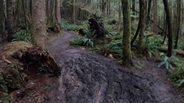
 Also lots of mud, this is one bit that seemed quite bad, but later on the route it got much much worse.  I was plastered in mud when I finished the whole run.  Some of it even tried to suck your shoes off... nice!

 I liked the trees here.

The first point in the run where the trail intersects anther that can either be a loop or you go all the way to Seaside, which is the way I went.  I put the camera away at this point because it was getting in my way dealing with the mud. 

Further on there was a few inches of snow, and it also started to snow through the trees again but didn't amount to much.

The elevation profile for the route.  The GPS was a bit off because of the thick trees so the distance is off where it drew straight lines.


Over all a good fun bit quite hard run.


Thursday, March 22, 2018

Neahkahnie_Mountain

March 22nd Run up Neahkahnie Mountain from Short Sands beach.

After finishing work it was time for my run.
This is a sea level to 1600 foot climb starting at the car at about 200 feet ASL, the trail drops down to sea level and then heads across a river and up through some steep switch backs heading South towards HWY 101 again.  After crossing HWY 101 the trail continues up until reaching the summit of the mountain.
Its not a long run but it's quite a hard one.  Lots of deep mud and really steep sections with exposed roots and stones.

Since it was really muddy and very slippery I didn't record or take any pictures until I got to the top.

This is looking down the last section which is a short 50 foot scramble to the top.


Me at the top.  It was cold and windy and there was a nasty storm on the way. South is behind me.

A view west across the top of the summit.


The storm was heading directly towards me so I didn't hang about up there.

Elevation profile of the run
When I got back to the car and was driving back home everything turned white with really heavy persistent hail stones.  Got down just in time!