Back County Rise:
https://www.daybreakracing.com/backcountry-rise-20m
Elk Kings:
https://gobeyondracing.com/races/elk-kings-25k-50k/50k/
I had a fairly high mileage month for June and done some back to back 50+ mile weeks, was feeling great and decided to top the month off with an epic run. I've wanted to have a go at the 50k distance for a bit of time now and felt like it was the right time to have a crack at it.
Saturday morning was wet and a bit windy when I got up at 6:45 AM and didn't seem all that appealing in my semi awake foggy morning-head state. Made my usual high octane oats and dried fruits breakfast (maybe a blog about that some time...) and had a cup of hot herbal tea. By this time the rain had pretty much stopped and having woke up a bit more the run seemed like a better idea.
I got all my gear packed into the running pack and double checked everything and headed out the door feeling ready for a long run. I had a goal of somewhere just under the six hour mark for this one. The route is pretty steep a lot of the way and goes from sea level at home to about 2,800 feet up to Onion Peak.
Took it nice and slowly and even (hard as it is for me) took it easy and didn't charge up the hills which I usually love to do.
The route is an out and back with one additional side spur to add six miles bringing the intended total run distance to the 31.5 mile +- a bit route for today.
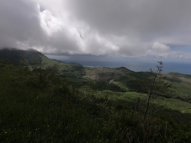
I didn't bother messing about with the camera too much because above 1800 feet ish was into the cloud base and visibility was down to just a few feet. I did take a handful of pictures on the way down below the cloudbase. They are posted below.
I drank and ate on the move, taking roughly 100 calories every 45 mins to an hour. Used a mix of raw honey and some oat based organic bars. I also had some real food, an apple and a banana which I'm glad I took.
Was up at the base of the summit in about two hours, I didn't go all the way to the summit though because its inside a wildlife protected area. This was at about the 12 mile mark. Then after being thoroughly soaked by running inside a cloud and from the long wet grass and bushes I headed back along the ridge and then back up a side spur a few hundred feet higher. Had a 5 minute food and maintenance stop there then plodded back down hill out of the clouds.
Looking back towards where I started from. (out of site but down there somewhere in the distance)
The mountain top where I ran to is behind that gray cloud over the horizon.
One of me just to prove I really was there 😃 The summit is in the clouds. This picture is at about 24 miles into the run. I bumped into a couple out hiking with their dog just before this picture was taken and stopped for a few minutes for a conversation with them.
Elevation profile. Total climb was 6,000 feet plus or minus a bit. Distance somewhere between 32 and 34 miles. The GPS on my watch was being a bit sporadic on the setting I was testing out so it wasn't totally accurate. I looked at the topographic map route and the elevation seems about right though.
Overall a great run and I' happy with the time, distance and elevation gain/loss.


