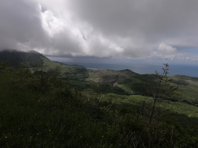
The last four attempts at this route failed to produce a view from the top due to the cloudbase dropping while I was going up.
The run started as usual from home and I made my way up through the Ecola Reserve park area and up into the wild bit of the hills.
Although the run to Ridge Spur isn't all that far at about 8.5 miles its a really hard one because of the elevation gain and a lot of it in a short distance.
Behind me is to the North with a view over the hill to Seaside.
Another view to the North. This is only about 850 feet ASL at this point. A long way to go yet.... and not many miles to do it in.
Finally a view from the top of Ridge Spur. The top of Ridge Spur runs almost Northwest to Southeast, so the view isn't all that good to the North from up here.
Looking East-ish
West-ish to the small town of Archcape.
I took a video from the top, youtube has removed a lot of the quality after it uploaded, but here it is.
Normally when I run up here because its such a brutal route I just head for home, but I wanted to have a longer run time wise today so I explored a new road up in this area.
This is the road I ran down, there's a dead end just past where I'm standing. It used to be a road but a landslide a really long time ago has closed it and there's new trees growing over it.
Strange rock formations exposed.
Along another side road off of where the pictures above were taken I ran down an interesting little set of hairpin bends than up onto a little hilltop. The picture below is from the top of that little hill. Looking Southwest.
The hairpins I ran down.
Looking Northwest towards Haystack Rock.
The run took me 3 hours 50 minutes including all the stops to enjoy the views. It came to 21 mies with 4500 feet of elevation gain and loss. My aim for this was to be moving for longer than usual on a harder route and I didnt care about pace or mileage. A race I'm signed up for in October will probably take me about 6 hours to complete, so I need to do more days like this and even longer ones.
Elevation and mileage profile.


No comments:
Post a Comment