Saturday, October 13, 2018
Wednesday, September 5, 2018
2018 Backcountry Rise 20 mile race
This weekend Brianne and I headed from home to the beautiful Mt St Helen's area where I participated in a mountain trail race.
We left on Friday afternoon with the car loaded with the tent and a load of home made organic food stuff for the weekend.
Arriving at the race location where the event organiser hired the Mt StHelen's Education Center where we had the use of the camping field and all the building facilities.
With the tent setup it was time for an early night ready for the race in the morning.
On Saturday morning the view from the tent door was stunning, with the double peaks of Mt St Helen's shrouded each with a lenticular cap.
It must have been pretty windy up there on the summit. The lenticular clouds are formed by strong wind over the rounded summit peaks where the airflow acts like an airplane wing.
View from the tent.
At the start line keeping warm, where it was pretty cold in the morning up at the 3,000 or so foot start/finish area. My race started at 9am, I snagged the last spot in the 20 miler when I booked this event.
I had a great time on the run.
Cruising down the hill somewhere between mile 1 and 4.
This worked out really well for me because I always feel warmed up and ready to go by about 5 miles into a run. The 5 mile area on this course is where it starts to climb almost 3,000 feet in only 4 miles in a constant climb. Hill climbs are where I excel.
(Photo credit to Pursuit Films)
At one point in this area I had quite a number of people following me, I guess they must have liked the pace I set for the pack, or was I just going too damn slow... I think not :) They all disappeared one by one till I got to the first aid station alone.
(Photo credit to Pursuit Films)
I crossed the finish line in 3hrs 39 mins 12 seconds feeling great. Jeremy Long the race director greets every finisher. I have a nice new pint glass for the effort and a reminder of a fantastic weekend out in the mountains.
(Photo credit to Pursuit Films)
It took a lot of mental effort to process the fact I came inside the top 10 male finishers and got my name on the finishers board. There were about 150 ish others behind me so I was elated to get a top ten result (9th Male, 11th overall).
I've been training for longer distance races and runs, and I went into this race not feeling like I was very well prepared or tuned for a short distance race and I didn't expect to place very well. How wrong I was!
Along the way I met and ran with a great bunch of like minded runners. Thanks to all of you who shared the trails with me.
After the race the RD provided hot food and drinks, which I really enjoyed.
The elevation profile for the race is below. About 5,000 feet of climbing and 5,000 feet back down over the 20 mile route in stunning back-country scenery. It was a privilege to get to run in the Mt St Helen's monument area and across the 1980 Volcano blast zone where the Earth literally turned inside out!
The picture below is a view of the route we took in the race. It dropped the 500 feet down to the lake, then went clockwise up the lake and at the top end climbed up and over the mountain just to the left of the center of the picture. The route then headed down and across the ridge at the right rear of the picture, its the second ridge back with the mostly clear top in the center of the right hand side. Then it went all they way back down and round the lake to make a complete loop then 500 feet back up to the start in the last mile.
Thanks for reading, If you liked my blog let me know.
Saturday, August 25, 2018
50k Run in the hills to experiment with food
This weeks long run was a 50k plus a little extra.
I needed to figure out where I was going wrong with crapping out after 25 miles and doing the walk, shuffle, and slow run dance to finish the route. I knew it had to be fuel related because after the run I felt fine, no muscle aches or other issues. It had to be fuel related and not simply lack of strength or endurance capacity.
So today I got a bunch of different food items together and loaded up a new running pack I was testing out with water food and lots of other essentials for a long day in the hills. The new pack seemed empty in comparison to the usual Ultimate Direction FKT vest. I'll do a separate blog entry for my gear some time in the future.
Enough water for a self supported six hour day is pretty heavy, but the new pack felt great.
The food I packed is listed below.
2x Cliff Bars - Coconut Choc Chip
- https://www.clifbar.com/products/clif/clif-bar/coconut-chocolate-chip
Not labeled as wheat free but close enough.
3x Date and Coconut chunks from a local Organic grocers. About 100 calories each.
1x Homemade Oat Bar, peanut butter and, honey and cocoa. About 100-150 calories.
2x medium sized boiled potatoes with a generous sprinkling of Himalayan Pink salt.
1x Banana.
2.5 Liters of filtered water.
Nothing contained wheat or sugar or processed ingredients. All pretty much real whole foods.
The Cliff bars are not perfect in that respect, but really convenient and taste great.
My idea was to have something every 45 minutes and wash it down with water.
I had one of the potatoes at about mile 13, then the other at about mile 20. The rest of the food I had spaced in between the salty potato.
The end result was I felt great and even about half an hour before the end I had the idea of refilling the water bottles and doing another 20 mile out and back over a hill in the other direction to do a 50 mile run. I would have done that, but I have a race next weekend and after this weeks high amount of miles that was a really dumb idea, so I bailed on that one. Plenty more opportunity to do that coming up.
Here are some pictures of the route today. I added some new paths and forest roads to a run I do from time to time to add the miles on to make it a 50k ish one.
A few random pictures of the route below.
The picture above is from when I reached a dead end on a trail/road but I could see another set of roads below that I knew intersected a road I just passed, so I wanted to get down there to do a loop. I noticed a fairly well used Elk trail ahead and going that direction so decided to go that way.
Elk have long legs thick skin four wheel drive and as I found tend to jump of 10-15 foot high ledges like they are level. Not so easy for us two legged human things!
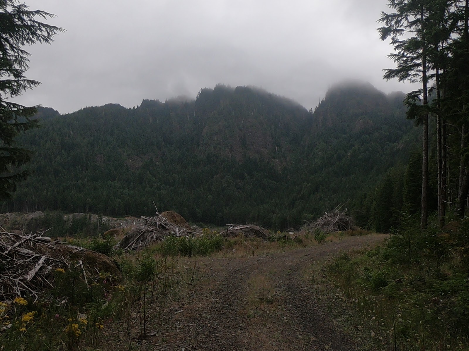
Today was a nice temperature and overcast so there were some really nice views of the hills.
This shows the road behind me that went to the dead end, the road in the left of the picture is where I came up from my Elk impression scramble to get to the roads.
Next time I'm going to run over all of these roads. Where I got down to.
Overall a great day out and I figured out how to fuel for a long race/adventure run. It might look a bit sketchy in places but its actually pretty safe going. Wild animals don't like human interaction and keep out of your way, its other humans (which you don't see many of this far out) that are the dangerous ones!
The stuff below is the route stats etc.
32.79 Miles
6,143 feet total climbing and loss.
Time:
Total time: 6 hrs 12 mins
50k Time: 5hrs 56 mins
My goal has been for a sub six hour 50k, I failed that the last two times. Done it this time! Happy!!
I needed to figure out where I was going wrong with crapping out after 25 miles and doing the walk, shuffle, and slow run dance to finish the route. I knew it had to be fuel related because after the run I felt fine, no muscle aches or other issues. It had to be fuel related and not simply lack of strength or endurance capacity.
So today I got a bunch of different food items together and loaded up a new running pack I was testing out with water food and lots of other essentials for a long day in the hills. The new pack seemed empty in comparison to the usual Ultimate Direction FKT vest. I'll do a separate blog entry for my gear some time in the future.
Enough water for a self supported six hour day is pretty heavy, but the new pack felt great.
The food I packed is listed below.
2x Cliff Bars - Coconut Choc Chip
- https://www.clifbar.com/products/clif/clif-bar/coconut-chocolate-chip
Not labeled as wheat free but close enough.
3x Date and Coconut chunks from a local Organic grocers. About 100 calories each.
1x Homemade Oat Bar, peanut butter and, honey and cocoa. About 100-150 calories.
2x medium sized boiled potatoes with a generous sprinkling of Himalayan Pink salt.
1x Banana.
2.5 Liters of filtered water.
Nothing contained wheat or sugar or processed ingredients. All pretty much real whole foods.
The Cliff bars are not perfect in that respect, but really convenient and taste great.
My idea was to have something every 45 minutes and wash it down with water.
I had one of the potatoes at about mile 13, then the other at about mile 20. The rest of the food I had spaced in between the salty potato.
The end result was I felt great and even about half an hour before the end I had the idea of refilling the water bottles and doing another 20 mile out and back over a hill in the other direction to do a 50 mile run. I would have done that, but I have a race next weekend and after this weeks high amount of miles that was a really dumb idea, so I bailed on that one. Plenty more opportunity to do that coming up.
Here are some pictures of the route today. I added some new paths and forest roads to a run I do from time to time to add the miles on to make it a 50k ish one.
A few random pictures of the route below.
Looking back towards the Ocean. Where I started from is just to the left of my head down a sea level.
The picture above is from when I reached a dead end on a trail/road but I could see another set of roads below that I knew intersected a road I just passed, so I wanted to get down there to do a loop. I noticed a fairly well used Elk trail ahead and going that direction so decided to go that way.
Elk have long legs thick skin four wheel drive and as I found tend to jump of 10-15 foot high ledges like they are level. Not so easy for us two legged human things!
Got there though, and that's where I scrambled very carefully down. its actually a lot further and steeper than the picture indicates.
Today was a nice temperature and overcast so there were some really nice views of the hills.
This shows the road behind me that went to the dead end, the road in the left of the picture is where I came up from my Elk impression scramble to get to the roads.
Next time I'm going to run over all of these roads. Where I got down to.
Overall a great day out and I figured out how to fuel for a long race/adventure run. It might look a bit sketchy in places but its actually pretty safe going. Wild animals don't like human interaction and keep out of your way, its other humans (which you don't see many of this far out) that are the dangerous ones!
The stuff below is the route stats etc.
32.79 Miles
6,143 feet total climbing and loss.
Time:
Total time: 6 hrs 12 mins
50k Time: 5hrs 56 mins
My goal has been for a sub six hour 50k, I failed that the last two times. Done it this time! Happy!!
Sunday, August 19, 2018
Elk and King Mountain run
The Elk King's Mountain race held in October has two courses, one a 25k up and over two mountain summits, the other is the 50k course which shares some of the 25k course minus the summits.
I decided it would be a great idea to spice things up and do both courses making a loop plus a long out and back including the near vertical assent/descent of the mountains. It didn't quite go as planned but was still a reasonable 21 mile run with a LOT of elevation gain and loss.
Me at my starting point in the Elk Creek campsite.
Tilllamook Forest has miles and miles of trails in an interconnected system. There are lots of options for starting points and parking.
Well sign posted too. This is the start of the trail form the Campground.
This is at the start of where it gets interesting, from this point it goes vertically directly up to 2700 feet. No switchbacks here folks!
First opportunity for a view part way up towards Elk Mountain Summit.
At the summit. Great clear views from here today.
Just to prove I was really there!
This is looking at Kings Mountain from Elk Mountain. I'm headed there next.
The route is to the right and curves round to the summit.
At the junction of Elk, King and a third trail I have not yet been on.
Yes, King Mountain summit is that way, not the little rock behind me.
After a lot more vertical climbing up and down and more up's and through some nice fast run-able forest trail you get to the King Mountain summit.
I refilled my water bottles from the bigger bottle I carry in the back of the pack. Had a bite to eat on the move off the summit and headed 2200 feet down to the Wilson River trail. I didn't take pictures on this section because its a bit "technical". I'll leave the description at that, use your imagination!
Quick picture from the summit before I headed off downwards.
This is 2200 feet lower and on the junction with the Kings trail and the Wilson River trail. The picture is looking up the Kings trail from the Wilson River trail. I'm heading to the left of this sign now.
One of the few views on this seven-ish mile section of forest trail. The trail goes through some nice valleys and dense forest. Great running trail too with a mix of up and down to break things up.
I stopped here by the edge of the river for some food. Salty boiled potato and a big lump of cheese was delicious at this point.
Looking down the river from where I had a bite to eat just before Diamond Mill OHV staging area. I'ts a really nice view here but completely spoiled by the awful noise and smell coming from the ATV's and dirt bikes being started up and apparently just revved to the limit for no reason.
The down side of the US is that the country promotes excess, greed, laziness and the desire to destroy every bit of the country with hydrocarbons and bullets. Why cant people just go out and play on a mountain bike or walk, run, climb! Everything in this damn country has to be powered by noise and oil pollution. John Muir and Roosevelt would be absolutely disgusted by how the land they aimed to protect and keep pristine for the future generations has become a playground for noise and greed!
This is where my run outwards ended. I followed the Wilson River Trail intending to get to the Forest Visitor Center about thee miles down the river, but after going round the edge of the OHV staging area the trail split up and the signs disappeared and I wasn't able to find the route that would take me down river. I'm going to have to re-do this run but from the visitor center and see where it meets this location. I had a map, but it wasn't detailed enough to see where the trail went.
My intent was to do about 34 miles out and back, but it got cut short to 21 miles.
Still a really good run with a LOT of elevation.
Elevation profile of the whole run. You can see the first bit just goes vertical in a really short distance. Then has another 1,000 foot-ish climb up then down to be repeated on the return journey.
I didn't go back over the mountain traverse, I might do that out and back another time for fun.
Map of where I went.
Total distance: 21.6 miles.
Elevation gain: Strava says 6,800 feet.
Duration including some quick food and maintenance stops: 5hrs 43 mins.
Subscribe to:
Posts (Atom)