The Elk King's Mountain race held in October has two courses, one a 25k up and over two mountain summits, the other is the 50k course which shares some of the 25k course minus the summits.
I decided it would be a great idea to spice things up and do both courses making a loop plus a long out and back including the near vertical assent/descent of the mountains. It didn't quite go as planned but was still a reasonable 21 mile run with a LOT of elevation gain and loss.
Me at my starting point in the Elk Creek campsite.
Tilllamook Forest has miles and miles of trails in an interconnected system. There are lots of options for starting points and parking.
Well sign posted too. This is the start of the trail form the Campground.
This is at the start of where it gets interesting, from this point it goes vertically directly up to 2700 feet. No switchbacks here folks!
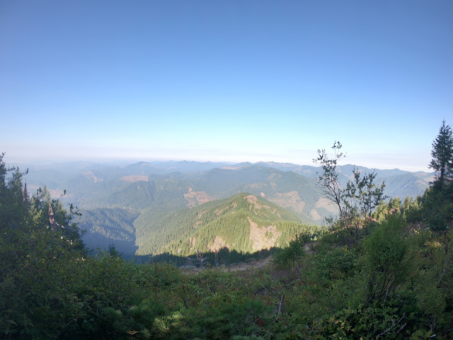
First opportunity for a view part way up towards Elk Mountain Summit.
At the summit. Great clear views from here today.
Just to prove I was really there!
This is looking at Kings Mountain from Elk Mountain. I'm headed there next.
The route is to the right and curves round to the summit.
At the junction of Elk, King and a third trail I have not yet been on.
Yes, King Mountain summit is that way, not the little rock behind me.
After a lot more vertical climbing up and down and more up's and through some nice fast run-able forest trail you get to the King Mountain summit.
I refilled my water bottles from the bigger bottle I carry in the back of the pack. Had a bite to eat on the move off the summit and headed 2200 feet down to the Wilson River trail. I didn't take pictures on this section because its a bit "technical". I'll leave the description at that, use your imagination!
Quick picture from the summit before I headed off downwards.
This is 2200 feet lower and on the junction with the Kings trail and the Wilson River trail. The picture is looking up the Kings trail from the Wilson River trail. I'm heading to the left of this sign now.
One of the few views on this seven-ish mile section of forest trail. The trail goes through some nice valleys and dense forest. Great running trail too with a mix of up and down to break things up.
I stopped here by the edge of the river for some food. Salty boiled potato and a big lump of cheese was delicious at this point.
Looking down the river from where I had a bite to eat just before Diamond Mill OHV staging area. I'ts a really nice view here but completely spoiled by the awful noise and smell coming from the ATV's and dirt bikes being started up and apparently just revved to the limit for no reason.
The down side of the US is that the country promotes excess, greed, laziness and the desire to destroy every bit of the country with hydrocarbons and bullets. Why cant people just go out and play on a mountain bike or walk, run, climb! Everything in this damn country has to be powered by noise and oil pollution. John Muir and Roosevelt would be absolutely disgusted by how the land they aimed to protect and keep pristine for the future generations has become a playground for noise and greed!
This is where my run outwards ended. I followed the Wilson River Trail intending to get to the Forest Visitor Center about thee miles down the river, but after going round the edge of the OHV staging area the trail split up and the signs disappeared and I wasn't able to find the route that would take me down river. I'm going to have to re-do this run but from the visitor center and see where it meets this location. I had a map, but it wasn't detailed enough to see where the trail went.
My intent was to do about 34 miles out and back, but it got cut short to 21 miles.
Still a really good run with a LOT of elevation.
Elevation profile of the whole run. You can see the first bit just goes vertical in a really short distance. Then has another 1,000 foot-ish climb up then down to be repeated on the return journey.
I didn't go back over the mountain traverse, I might do that out and back another time for fun.
Map of where I went.
Total distance: 21.6 miles.
Elevation gain: Strava says 6,800 feet.
Duration including some quick food and maintenance stops: 5hrs 43 mins.


Brilliant for an old guy with grey hair and beard
ReplyDeleteAye, cheers. Trying to run away from old age, ha ha.
DeleteThe beard suits you. I hope You are well. It must be 25 years since I saw you last. Enjoy life and live the dream.
ReplyDeleteNot sure who you are "UnKnown" but cheers for the comment.
Delete